An Introduction to our Home
By Lorne Fitch, P. Biol.
If you look at the back of your hand, and the branching veins reaching up into your fingers and then leading down your arm to the rest of you- that gives you a picture of the Oldman watershed. The fingers, which are the major contributing rivers, provide the form of the watershed. The five major ones are the Oldman, Crowsnest, Castle, Belly/Waterton, and St. Mary rivers. Less evident are the dozens of named tributaries and more unnamed ones. Water flowing down and beneath those channels breathes life into southern Alberta.
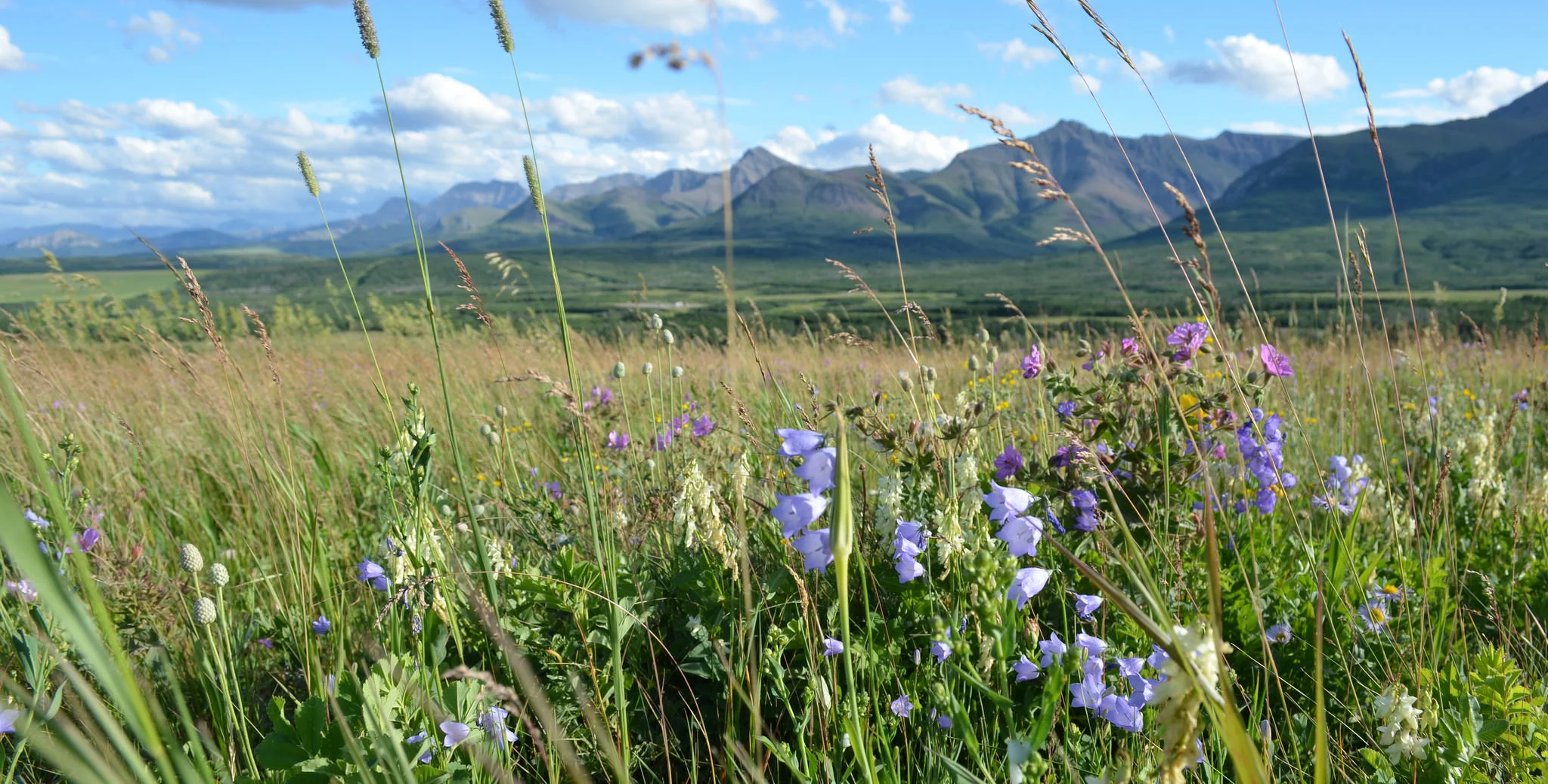
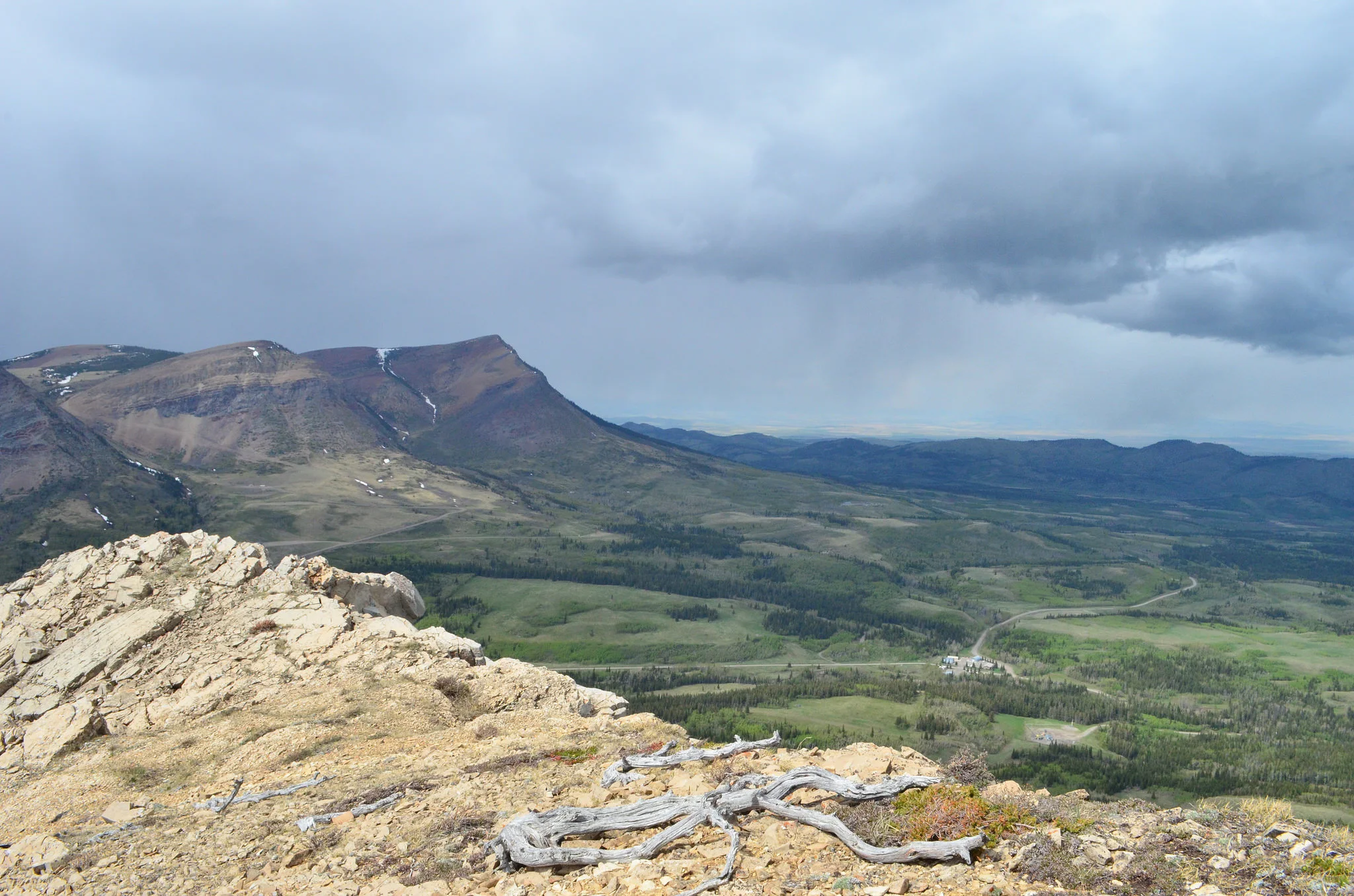
Looking down on the watershed from a high altitude the bordering mountains are a naked and serene backbone of twisted and tortured rock. Forests of conifer cling to the slopes and begin to thin towards the rolling fescue grassland of the foothills. As the elevation drops and flattens there are the remains of the native prairie, its tawny skin stretched tightly over a largely treeless expanse. From west to east run sinuous ribbons of water, connected like veins in a leaf. Amid this are a few splashes of blue, natural lakes, their receptacles gouged out by glaciers. Larger bodies of blue, some on rivers, some formed in large coulees, are the reservoirs that trap some of the watershed's flow. From the lead straighter channels, the irrigation canals convey water to fields in the eastern portion of the watershed.
Equally evident is the road network, from logging trails in the headwaters, along grid roads of gravel, to four-lane highways and streets to driveways and tracks on the prairie ending at a well site. The transportation network ties our human footprint together from straight-edged clear-cuts, rectangular farm fields, green irrigation pivot circles, gas and oil field developments, gravel pits, electrical transmission lines, rail lines, factories, and processing facilities to the layouts of our cities and towns. Less evident as a human footprint are the administrative boundaries and lines; municipalities and counties, irrigation districts, government agency regions, electoral areas, the Pikani and Kaini reserves, the Forest Reserve, several provincial parks, two national parks (one in the United States) and an international border.
This is a landscape of relative newness, geologically speaking. Tectonics formed the backbone of the watershed, the mountains of the continental divide, ending in a wink of cosmic time about 25 million years ago. Our mountains, then, rivaled the Himalayas but subsequent erosion has ground them down and scattered much of their remains eastward. Alpine and continental glaciations then shaped the watershed in an epoch that ended a scant 12,000 years or so ago. For the next 11,900 years, give or take a few, other forces, including climate, erosion, fire, drought, floods, and grazing combined with plant growth, movement, and succession to give us the landscape we are familiar with today. Those forces are still at play beneath the radar of our day-to-day observations and our human footprint.
“Few places on earth can offer such a diverse voyage.”
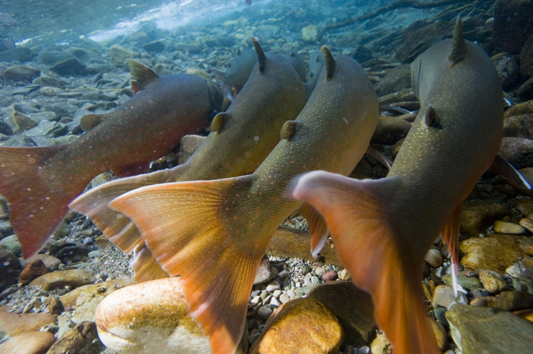
A three-hour drive, at the legal speed limit, will take you from the mountains, the Oldman watershed's western boundary to the eastern edge, at the confluence with the Bow River in the grassland. The passage from the Rocky Mountain natural region, through a sliver of the Foothills natural region, to the Grasslands natural region is brief but breathtaking. Few places on earth can offer such a diverse voyage. We can transport ourselves from cutthroat and bull trout to lake sturgeon and walleye; from bighorn sheep and grizzly bears to antelope and rattlesnakes, and from limber pine and rough fescue to blue grama grass and cactus. We can shiver at an elevation of 2500m on Mt. Lyall at the headwaters of the Oldman River or fry in a corn field near Grassy Lake at 600m. We can ski on several meters of snow one day and at the other end of the watershed watch moisture disappear as evaporation exceeds precipitation. Our riparian cottonwood forests, an emerald thread of green in the summer, are oases of shade, shelter, and coolness meters away from scorching temperatures and an unforgiving sun. Bird song, deer, rabbits, and insect life in these forests suggest an area of high biological diversity and interest. Diversity, variety, and extremes typify the Oldman watershed.
Relatively new is the human footprint in the watershed. Archeologists inform us that 11,000 years ago on the banks of the Oldman River, near present-day Taber, a primitive hunter butchered a buffalo. Buffalo became the mainstay of native peoples, hunted with vertical “jumps”, pounds, and later from horseback. Some recent evidence suggests buffalo formed the first prairie economy, with pemmican produced and subsequently traded over a large portion of the continent. It is from these first peoples that the name Oldman comes to us. The Old Man, an English translation of the Blackfoot name “Naapi”, was a wise, mythical Indian character possessed of supernatural attributes. His playground and the root of many of his myths and stories were centered in the headwaters of this watershed.
The ceding of Rupert's Land to the Hudson's Bay Company (an early precursor to today's multinational corporations) by the British government in 1670 sparked the next economic milestone, that of the fur trade. The need to capture and transport the lucrative fur resource lead to exploration and put form to the vastness of the HBC holdings which was the entire Hudson's Bay drainage, including what is now southern Alberta. The earliest reference to the Oldman watershed comes from Peter Fidler whose explorations lead him to Willow Creek and the upper Oldman River during travel with native guides over the fall and winter of 1792-3. In less than a hundred years the North West Mounted Police marched into the watershed, to end the depredations of the fur industry and to exercise some sovereignty in western Canada to counter the territorial imperatives of the American government. This stabilizing force created the incentive for the pattern of development that began before the turn of the last century and one that continues today.
The concerns of central Canada over sovereignty in the west morphed into nation-building. Early federal lawmakers recognized by the 1880's the pivotal importance of water for settlement and economic development on the prairies. Despite the lack of critical or comprehensive inventories of water resources a clear intent to secure water was articulated in 1884. That was followed, in 1911, with the entire Eastern Slopes of the Rocky Mountains being set aside by the federal Department of the Interior for “the protection of watersheds, and for the maintenance of conditions favourable to a continuous water supply”. A watershed approach clearly isn't new as these early policymakers recognized the connections between the headwaters in Alberta (and conditions there) and the sustainability of settlement and economic development for Alberta as well as Saskatchewan and Manitoba. The historical direction, planning, and policy for the Oldman watershed (as part of the Eastern Slopes) were strikingly prescient, strategic, and inclusive.
Settlement in the Oldman watershed began with ranching, taking advantage of an emerging local (and later national and international) market for beef following the demise of bison populations. This economic endeavor closely matched natural patterns but was inhibited by the inability of cattle to successfully overwinter without supplemental feeding. Ranching also did not provide the settlement density desired by the federal government. Settlement policies, programs, and inducements by the federal government (and supported by the CPR who had a vested interest in seeing the prairies populated) lead to a massive movement of people to the watershed to capitalize on free (or cheap) land. Many settlers survived and thrived despite exaggerated advertising claims by land agents, the uneconomic scale of 160-acre parcels, and often insufficient and incorrect farming advice, all of which added to a landscape of extremes mostly related to a scarcity of water.
To some early settlers confronted by a lack of water, the response was to move to where water was more plentiful. To others, the solution was to move water to them. Small-scale water diversions, on an individual basis, lead to larger irrigation initiatives at a community level, to the formation of land development businesses. With economic downturns, governments intervened and invested in irrigation infrastructure. The next step has been the evolution of the present system of Irrigation Districts mandated by provincial legislation, partially supported by government investment, and operated as farmer-owned cooperatives. Irrigation agriculture has high investment costs (some borne by individual landowners, some by the provincial taxpayer), has higher returns with enhanced crop production, allows the cultivation of specialty crops with higher value, and supports an agricultural industry of specialty equipment, services, and food processing. All agricultural endeavors depend on water; irrigation agriculture by virtue of crop choices and investment is dependent on reliable, continuous water supplies.
The Oldman watershed lies in the rain shadow of the continental divide and the interior mountain ranges of British Columbia. These mountains skim off most of the water coming east from the Pacific. Precipitation declines from west to east. We live, comparatively speaking, in a dry land. Until recently that aridity went mostly unnoticed because of low demands from a small population in southern Alberta. Increasing demand from a population with expectations of growth and stability will be the challenge for managing the scant few centimeters of moisture that leak over the continental divide. We, in the Oldman watershed, survive on annual snowmelt and rainfall, with a modest and shrinking contribution from the glaciers of Glacier National Park in Montana. Learning to survive on less will be our challenge.
How well we have managed water in our watershed to this point is a complex story, seen and interpreted through multiple lenses. We have, by many accounts, a healthy economy, supported by the multi-faceted use of water to irrigate, grow and process food and produce other commodities. Water quantity has not yet impacted urban use and growth, although some troubling signals about water quality are evident. As cities and towns grow, the demands from a largely urban population in the watershed coupled with conservation needs will test our ability to share equitably the resource in shortest supply.
At some levels, there is an understanding of the reality of limits and thresholds. The closure of the South Saskatchewan River Basin to further diversions provides an important step. To some degree, however, limits have already been exceeded in some reaches of rivers and streams in the Oldman watershed. For some parts of the year, these reaches no longer function as biological entities, with the full spectrum of ecological processes, functions and benefits, but rather as degraded systems without enough flow. As a function of history the decisions about water management over the last 100 years have provided substantial economic benefits, created ecological consequences and foreclosed on opportunities for other choices, given the challenges of an uncertain future. We find ourselves at a pivotal point that requires us to reflect about the past, understand our present circumstances and weigh the trends and trajectories to plan a future that maintains a mix and balance of economic opportunity, environmental protection and social needs for the residents of the watershed. Key to this will be the understanding that the watershed (and the rivers and streams that form it) requires a certain amount of water in order to serve its needs, as well as ours.
It will challenge us as we begin to think with more clarity about the headwaters of the Oldman watershed and the importance of better protecting and maintaining the source of our water, that in a larger way, we are the headwaters for people beyond our watershed, both downstream in Alberta and for Saskatchewan and Manitoba. If we develop a new understanding within our watershed about responsibility and stewardship, those concepts must flow downstream to our neighbours. In that way, we will not lose faith in the direction of past visionaries whose watershed thinking was at a scale much larger than the part in which we live.
“The future of water management may well be to become better attuned to the watershed and to see what needs it has, to maintain its critical functions, upon which we depend. ”
We've given water much advice, in the form of dams, reservoirs (both on-stream and off-stream), diversions, and canal networks to direct water to our needs and wants. That was no small engineering and financial feat. Existing infrastructure may provide us with options and flexibility to deal with some of the future challenges. The future of water management may well be to become better attuned to the watershed and to see what needs it has, to maintain its critical functions, upon which we depend. Our past practices will be a guide for the future, but not a template or recipe for water management.
How do we rearrange our thinking to prepare us for the realities of an uncertain future of climate change, increased population and development pressures, greater demands on a shrinking resource, and potential loss of key ecological functions and biodiversity? We might begin by dealing more quickly, forcefully, and proactively with the perception, or myth, of abundant amounts of water in the Oldman watershed. Conversely, there is no “magic” available to make more water.
We need to create a “community of communities” in the Oldman watershed that recognizes their connections are not solely through road networks but with the ecological connection of water. Linking people through the arteries that convey water is a key step to watershed thinking and activities in favor of watershed health. Thinking like a watershed might lead us to consider marrying land management with water management. The health of our water is a principal measure of how we live on and use the land. For too long we have separated, with administrative boundaries, bureaucratic silos, and differing economic interests what we do and manage in the uplands from how we manage water. It leads us to an artificial separation of the headwaters (the water provider) from the downstream portion of the watershed (the water user).
Watershed-level work seems overwhelming because of the scale. However, there are ways to make watershed scale work more manageable. The first step might be to recognize that we can manage cooperatively what we can't individually. That is an old, powerful concept called “community”. All of us in the Oldman watershed belong to some community, usually at a municipal or county level; it could be a small watershed group operating on one of the many tributaries to the major rivers. At those levels, every community boundary includes a larger portion of the watershed than that of an individual property owner. Add the work of many communities (and watershed groups) together and much of the Oldman watershed might be found within those boundaries. All of us that live in the Oldman watershed are part of it and are connected to one another.
The challenge for us in the Oldman watershed is not a new one; it is one that has been with human society for millennia. Aldo Leopold, an ecologist and philosopher, articulated it this way, in 1938:
“We end, I think, at what might be called the standard paradox of the 20th century: our tools are better than we are, and grow better faster than we do. They suffice to crack the atom, to command the tides. But they do not suffice for the oldest task in human history: to live on a piece of land without
spoiling it.”
This is a step, in Leopold's terms, to begin to understand what we have, the challenges we face, and how we will make the decisions of today that will provide the desired future in and for the Oldman watershed.
Related articles on watersheds