
What key parts of the environment do we need to keep in order to have functional ecosystems? How do we measure the impact of human activities on the health of the environment? What tipping points exist that we need to avoid? What clear themes are well established in research?
A comprehensive review of research was completed in May, 2013 that attempts to answer these questions and more.
The report is called Landscape Patterns Environmental Quality Analysis.
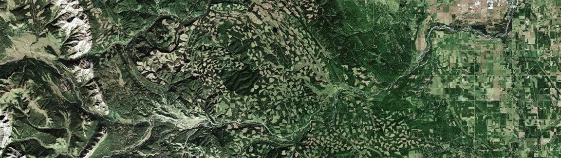
Landscape pattern analysis is based on the premise that there are indispensable patterns in any landscape that, if maintained, will conserve essential landscape processes. These landscape processes, in turn, strongly influence water quality, biodiversity, and other valued environmental components.
Concise pattern-based indicators and targets for environmental quality can inform cumulative effects management and sustainable development by providing measurable criteria for how resource extraction and other human activities can be managed on the landscape in concert with ecosystem function.
The Landscapes Patterns project is intended to provide support to multiple organizations with an interest in achieving environmental outcomes on landscapes of varying scales in the northwest part of the North American continent in general and in Alberta in particular. The project undertook a literature review of publications that show a relationship between human land use and land-use patterns and the qualitative state of various parts of the environment. Most published research focuses on wildlife species and water quality.
The successful consultant was O2 Planning and Design. Deliverables include a report and annotated bibliography, a citations spreadsheet, and a presentation.
Various map files were also produced as part of the project. The intent is to set up a spatial or keyword searchable function on the LC Map website and to allow website users to add citations to the citations and bibliographic database.
A second phase of the project will involve collaboration amongst the funding parties regarding ways in which landscape metrics can be used to support environmental outcomes in land use and conservation planning.
FUNDERS AND PROJECT PARTNERS
The project was a collaboration amongst various funding partners:
Alberta Environment and Sustainable Resource Development (Project Sponsor)
Oldman Watershed Council (Project Manager)
Department of National Defence: Canadian Forces Base Suffield
Great Northern Landscape Conservation Cooperative
Plains and Prairie Potholes Landscape Conservation Cooperative
Prairie Conservation Forum
Crown Managers Partnership