


1
2
3
4
5
6
7
8
9
10
11
12
13
14
15
16
17
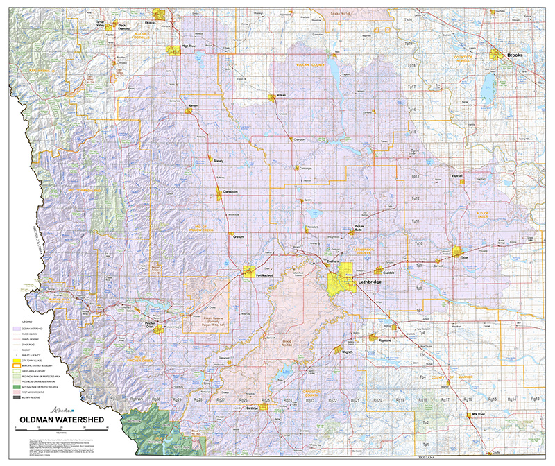

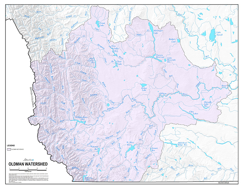
The Oldman Watershed
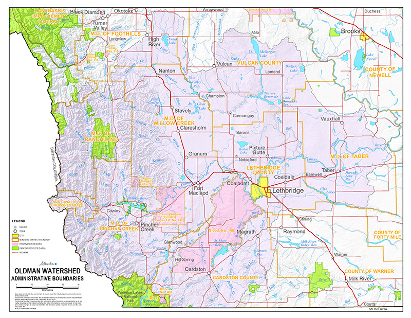
Oldman Watershed Administrative Boundaries
Detailed Oldman Watershed Map
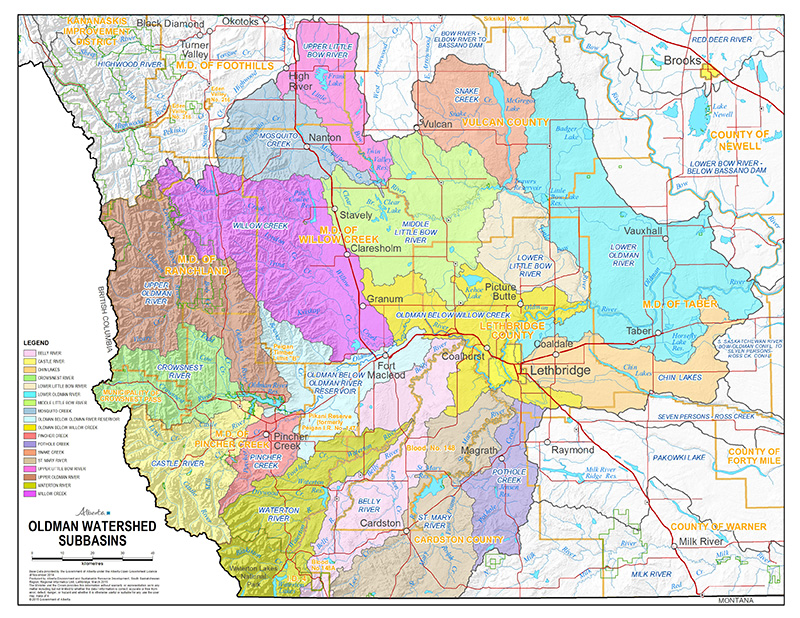
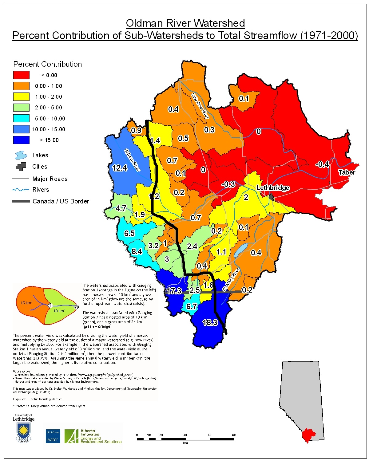
Oldman Watershed Subbasins
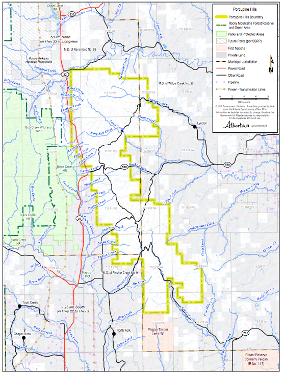
Porcupine Hills Boundary Map
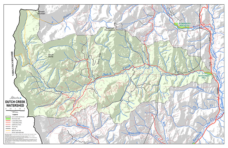
Dutch Creek
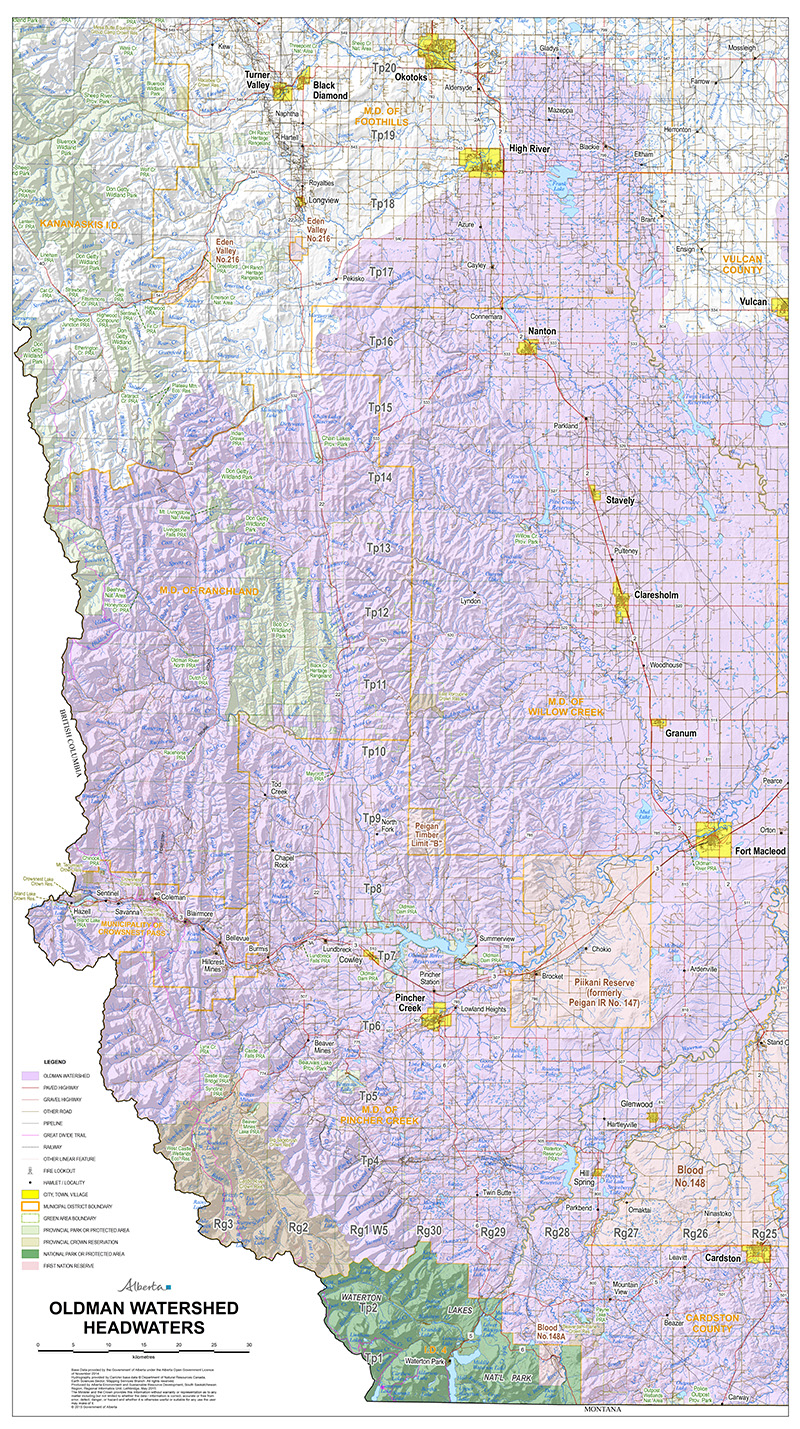
Oldman Watershed Headwaters
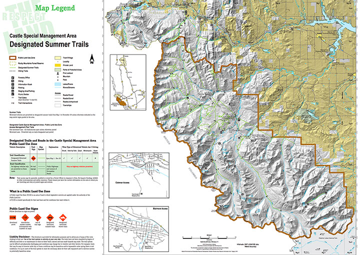
Summer Map of Castle (2010)
Source: Government of Alberta
Download High Resolution PDF
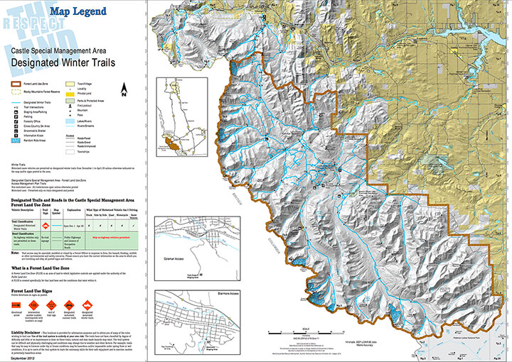
Winter Map of Castle
Source: Government of Alberta
Download High Resolution PDF
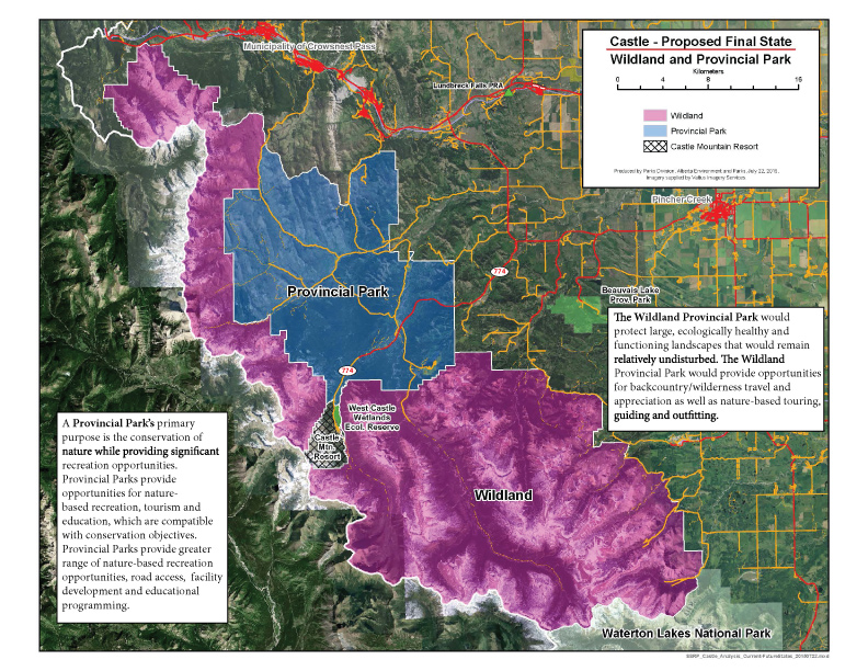
Castle Proposed Final State (2015)
Produced by Parks Division, Alberta Environment and Park.
Download High Resolution PDF
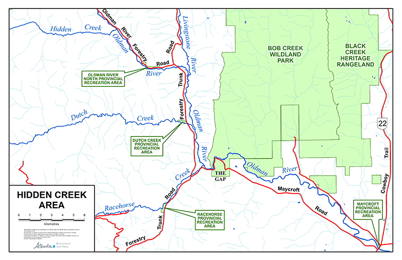
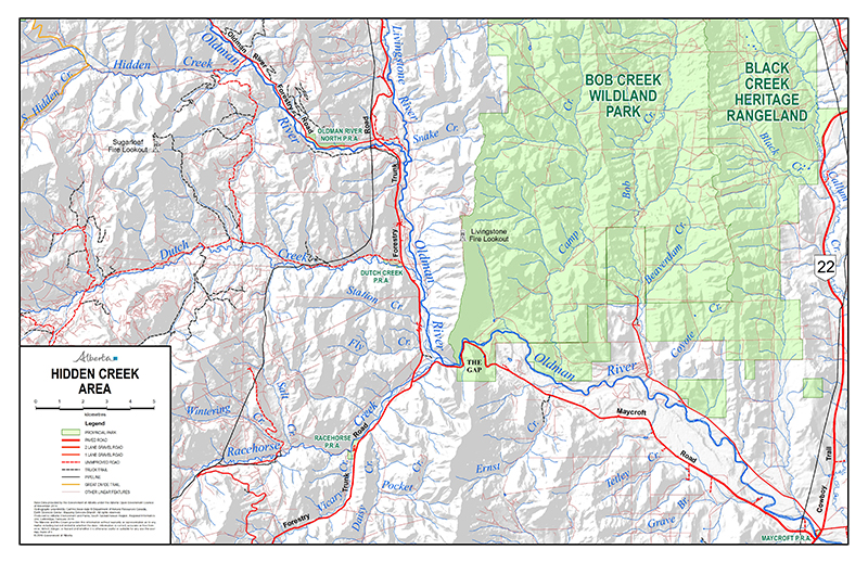
Hidden Creek Area
Source: Environment and Parks, Government of Alberta
Download a high resolution PDF
Hidden Creek Area - Detailed
Source: Environment and Parks, Government of Alberta
Download High Resolution PDF
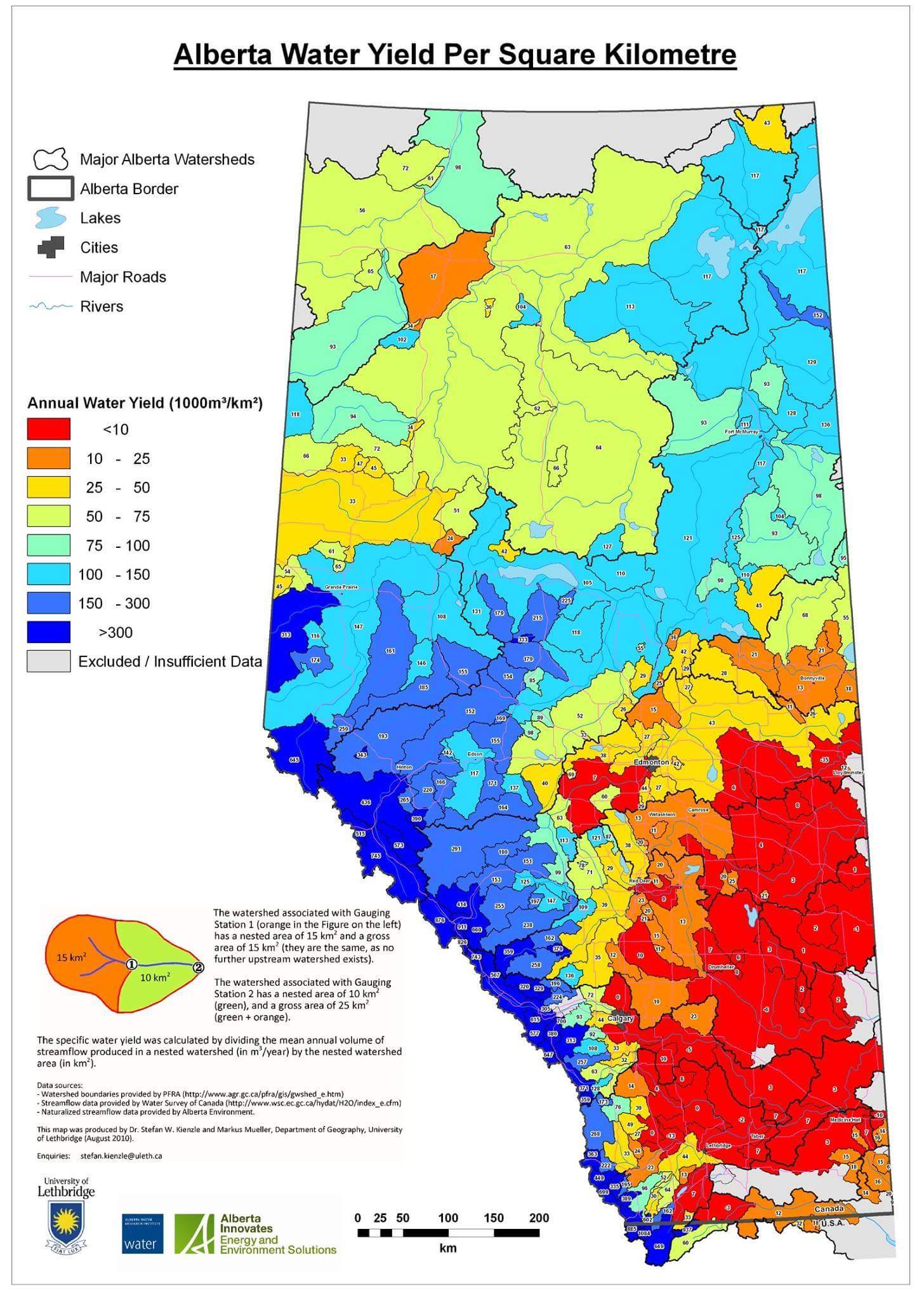
Percent Contribution of Sub-Watersheds to Total Streamflow (1971 - 2000)
Map produced by Dr. Stefan W. Kienzle and Markus Mueller, Department of Geography, University of Lethbridge.
Alberta Water Yield Per Square Kilometer
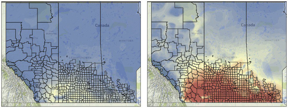
Prairie Climate Atlas
If these climate change predictions come true, massive heat waves will be the norm. The map on the left shows the current situation: Most of the Prairies is shaded blue (meaning 10 or fewer days when the temperature tops 30 C) with only Palliser’s Triangle in the light-green or yellow zones (20 to 25 days of +30 C). On the right is the prediction for the years after 2050 if there isn’t a reduction in greenhouse gases — with 30 to 45 days of scorching hot weather in a typical summer. Source: Alberta Farmer.
MAP GRAPHICS: Prairie Climate Atlas
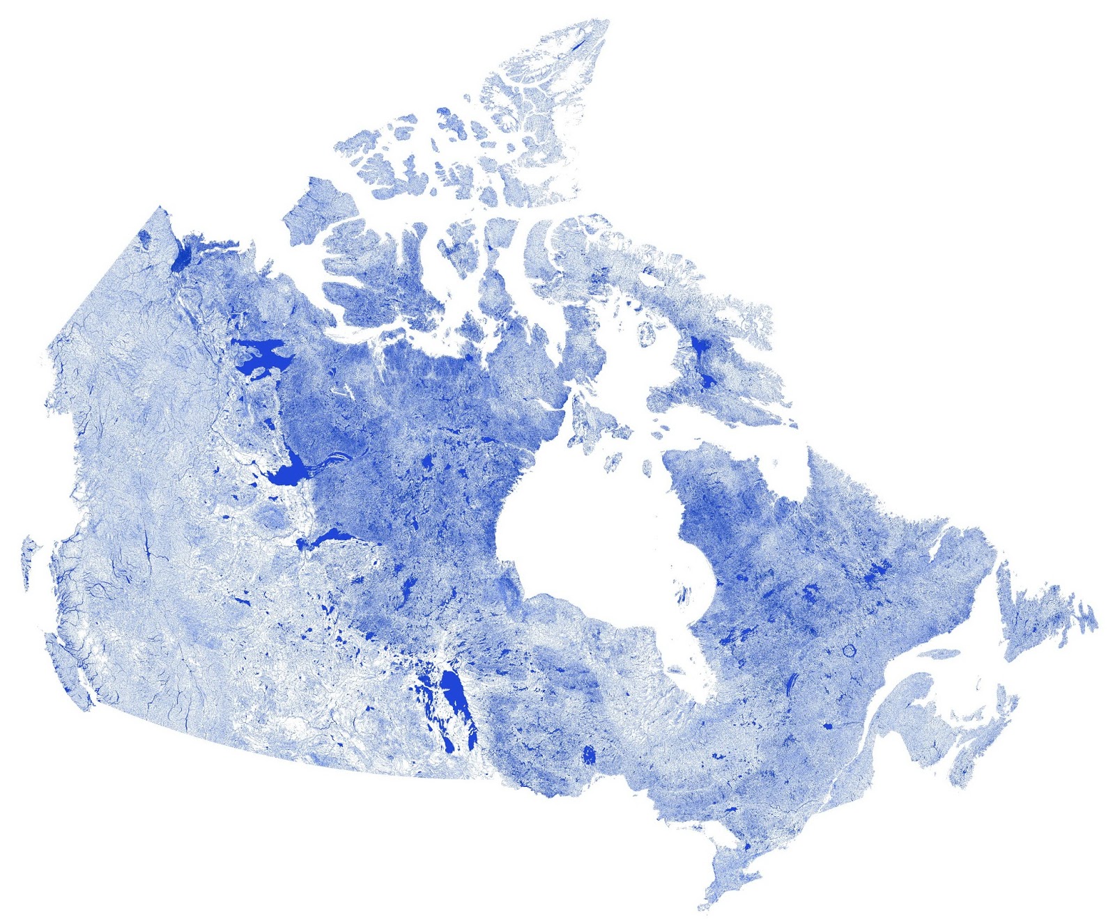
Canada mapped only by rivers, streams & lakes
By Vivid Maps. See more here.
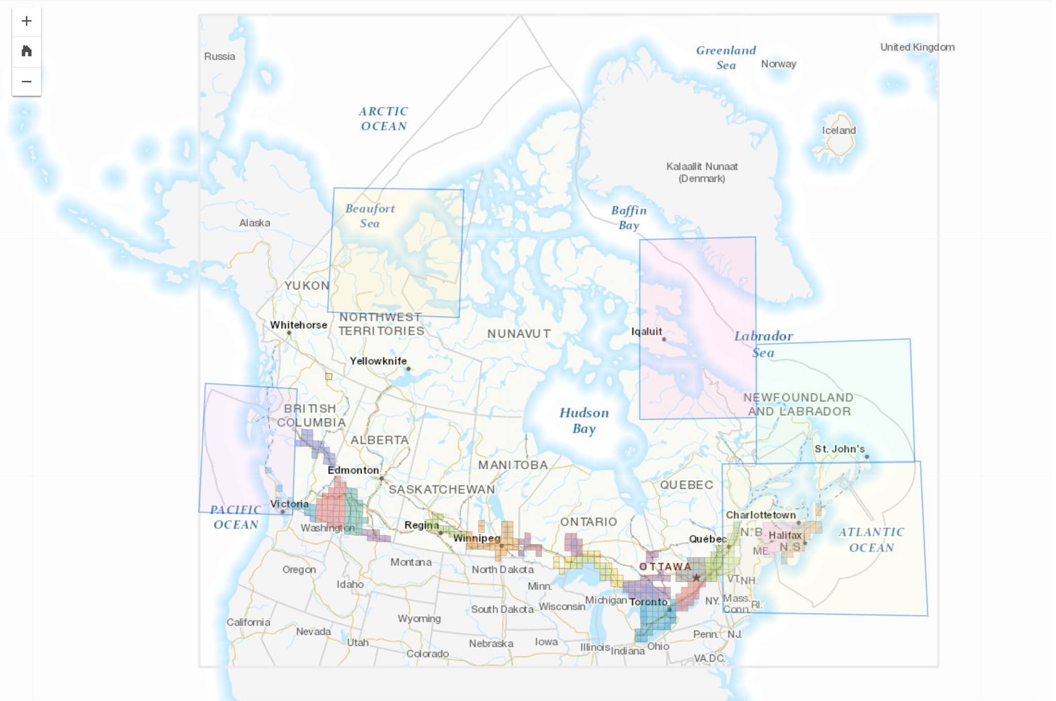
Aquatic species at risk maps