Curious about our water supply, river flow, or flood and drought advisories? You’ll want to download the Alberta Rivers: Data and Advisories app or visit the Alberta River Basins webpage (https://rivers.alberta.ca/).

The Alberta River Basins app and online tool allows you to explore real-time river flow data, water shortage advisories, and water quality.

This map-based tool allows you to explore data and water advisories from monitoring stations across the province. Using the menu on the right-hand side, you can toggle on and off layers like real-time flow data, water shortage advisories, water quality, and environmental data. For planning purposes, you can also look at current reservoir levels, a precipitation radar, forecaster comments, and mountain snowpack.
Snowpack and precipitation are particularly important in the Oldman watershed, since rain and snow melt are what provide most of the flow for our rivers. Water levels and flow vary seasonally - they’re higher during the spring melt, filling the reservoirs, and taper off over the summer. Above- or below-average levels can mean flooding or drought.
On the Alberta Rivers map, by clicking on a monitoring station, you can view and download data tables and graphs comparing current levels to weekly and yearly averages. The precipitation layer (cloud and raindrop icon) indicates precipitation from the last 48 hours. The snow pillow layer (snowflake icon) indicates snowpack depth in millimeters.
To access real-time flow data (in cubic metres per second) and flood advisories, select the flowing water icon at the top of the legend. For water shortage advisories, select the water tap (second icon on the legend). With the water management layer on, water taps will pop up all over the province, in different colors. Blue water taps indicate normal flow; yellow means lower than normal, and red indicates very low water levels.
As of June 13, there are red water taps upstream of Lethbridge and near Fort Macleod, meaning that the sources (rivers) we draw our water from are very low. Downstream, the Oldman River near the mouth (northeast of Taber) is also indicated in red. Further upstream, the Castle River near Beavers Mines is also red (very low flow), and the Crowsnest River at Frank is in yellow (low flow).

Water levels are very low on the Oldman River near Lethbridge. By clicking on a water monitoring station, you can click to download a data table, weekly or yearly graph, or report, or add the station to your Favourites.
What does this mean for our flood or drought risk? Spring is normally the time of year with the highest water levels and therefore the highest risk of flooding. With current water levels below average for the Oldman River, the risk of flooding is relatively low, unless we were to get an intense storm with a lot of rain in a very short amount of time.
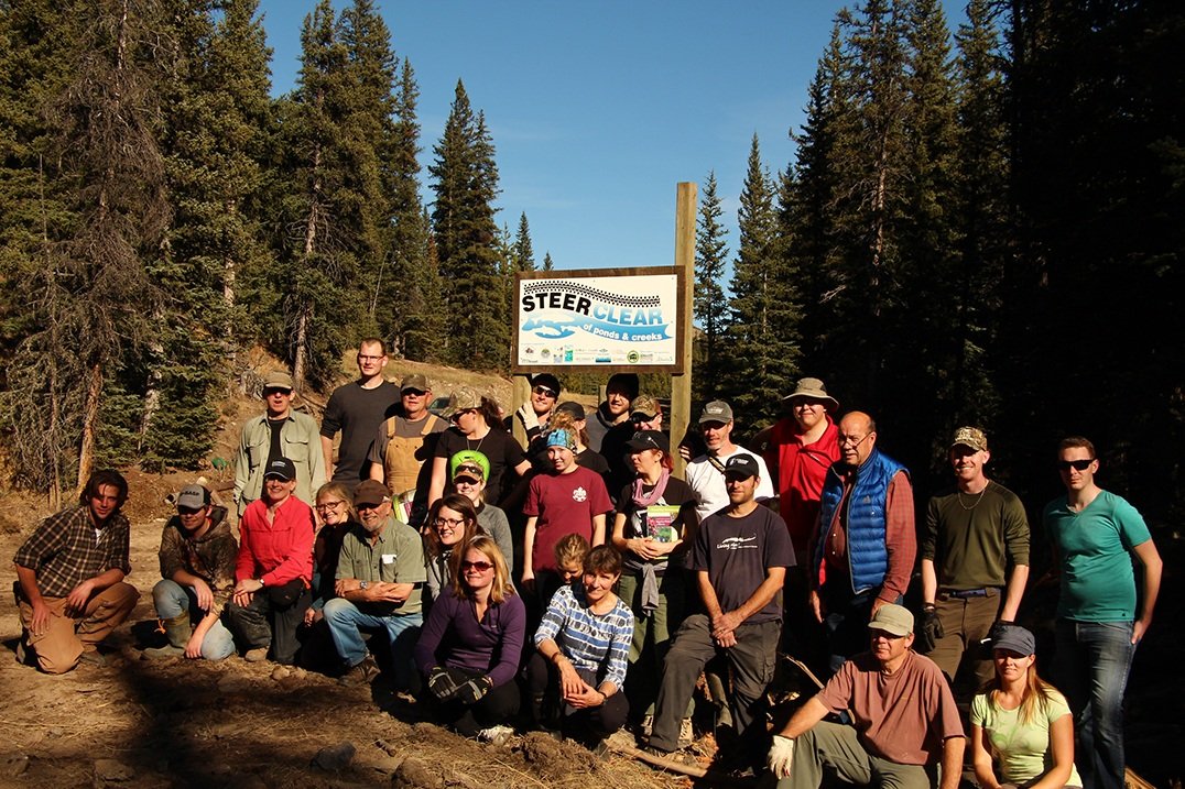
These low spring flows and reservoir levels could impact our water supply and risk of drought this year. Municipalities may opt to implement water rationing plans. During water shortages, irrigation districts (of which 9 out of Alberta’s 13 are in the Oldman watershed) have agreed to share their water allocations with other users in the watershed, and reduce the amount of water delivered to irrigators. So far in 2019, the St. Mary River Irrigation District and Lethbridge North Irrigation District have reduced their water use to 14 and 12 inches per irrigated acre, respectively - down from the usual 16 to 18 inches per irrigated acre.
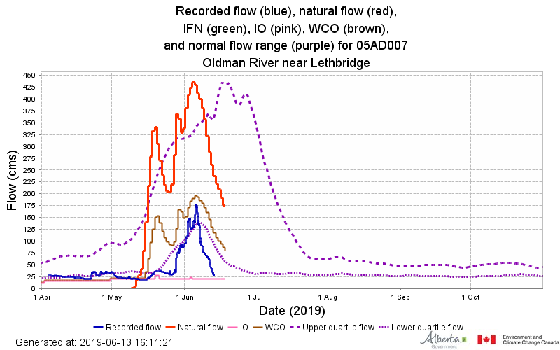
The recorded flow (blue) for the Oldman River near Lethbridge is much lower than the natural flow (red) and even the normal flow range (purple).
WCO = Water Conservation Objective. The amount and quality of water necessary for the protection of a natural water body or its aquatic environment.
IO = Instream Objective. Regulated flows that should remain in the river via dam operations or as a restriction on licences.
Reference: Approved Water Management Plan for the South Saskatchewan River Basin (Alberta) - August 2006
Water is a basic necessity for all life that we all need to share and use responsibly so we can continue to have high-quality water for future generations. So this summer, consider adopting some water conservation measures like fixing leaky faucets, installing rain barrels, and watering your yard in the evening (when evaporation is lower). Keep an eye on rivers.alberta.ca for water shortages and other advisories.