(Editor's note: OWC's Planning Manager, Connie Simmons, weighs in about a little understood aspect of watershed management and health. As always, we welcome your comments and your submissions as guest bloggers!)
What do linear features – that is all roads, seismic lines, powerlines, pipelines, railroads, cut lines, and recreation trails - have to do with a healthy watershed?
Well, in a nutshell, too many of these
linear features
(LF) - where they are placed, and how are they are used - can be a
risk to watershed health. And a risk to watershed health is a risk to our water quality, quantity and continued health of ecosystems that support us all.
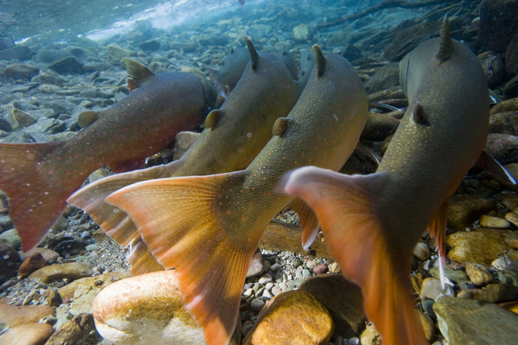
All that water coming out of the sky in the form of rain or snow eventually runs over the watershed lands, along ditches, through culverts, on and through clear-cuts, quad trails, roads and power-line right of ways – and flows into the Oldman River system. Depending on how and where they are developed and the way they are used, LF proliferation is shown to have adverse impacts on water hydrology - affecting ground water re-charge and surface run-off, erosion and sedimentation in streams, impacts on aquatic ecosystem health (fish and benthic invertebrates (water bugs) and extra cost to public water utilities to address water quality needs for our growing communities.
Necessity
We Albertans have been very busy with building communities, and infrastructure that supports the people who live, work and play in this region of Alberta. All of this development has depended on the building and maintaining of linear features.
For every need to develop these LF, we have constructed and used these features without too much thought on how all of this cumulatively impacts the foundation of a healthy functioning watershed. While this development was accepted as a necessity for economic, social and cultural well-being, scientific assessments and the concerns of the local communities have flagged the proliferation of LF and intensity/type of their use as a problem.
This has raised the need to do something about this growing concern for watershed health, particularly in the
headwaters
area of the Oldman River system.
Risk
The headwaters of the Oldman watershed provide approximately 90% of the water for the Oldman River – it is a critical water tower for southwestern Alberta.
Linear feature proliferation has been evaluated in the headwaters region, and 77% of the sub-watersheds in the headwaters are at moderate to high risk and pressure from this kind of development.
See the Headwaters Indicator Report.

Oldman headwaters area with all linear features (ESRD 2012 data)
The OWC completed the Headwaters Action Plan 2013-14 (HAP) in early 2014. The HAP was developed by the multi-stakeholder Partnership Advisory Network, and revised and completed after a thorough public review process.
The plan addresses the need to properly manage the increase and use of LF, and rollback and reclaim LF where there is moderate to high risk to water and watershed health.
The HAP is a good start, but it is only a plan. We need to
ACT
on it.
(For more information see the ‘What We Heard’ public review of the HAP at:
http://oldmanbasin.org/files/1613/9757/4313/Headwaters_What_we_Heard_Report_web.pdf
The
Headwaters Action Plan Summary Report
will soon on the website. If you would like a PDF of the report, please email
The OWC’s Headwaters Action Plan provided recommendations and advice to the South Saskatchewan Regional Plan (SSRP), and to an important sub-initiative of the SSRP - the Linear Footprint Management Plan (LFMP).
Currently, the LFMP is integrating multiple data and information sources to analyze, plan and eventually implement actions that address LF proliferation in the Oldman headwaters and elsewhere in the SSRP region.
The OWC’s
Headwaters Action Team
is keen to understand, and where possible assist with this important work as it is a key priority of the Headwaters Action Plan – and we have made progress with this endeavor by recent completion of the
‘Linear Features Classification’ project
in the
Dutch Creek sub-watershed in the Oldman headwaters.
Historically, Dutch Creek has been mined, logged, grazed and has multiple LF to attest to this history. The majority of LF continue to be used for other purposes than their original use, and the intensity and type of this use needs to be managed to safeguard key water/watershed values.
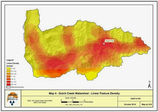
Dutch Creek Watershed Linear Features Classification Project – December 2014
Risk to watershed health by linear feature proliferation in the Dutch Creek sub-watershed is indicative of what is going on most of the Oldman headwaters.
It is a sobering thought. The risk to water and watershed health that supports all who live and work downstream needs careful attention, and that includes education and social willingness to address the issues that go along with the proliferation and intensity of use of linear features.
Trade-offs
It is hard for Albertans to seriously consider trade-offs when it comes to protecting and/or using resource rich areas. The iconic wild west has been a place of opportunity, and we have taken advantage of resource richness for over a century.
However, as we reach limits to how much can be done on the landscape without compromising future opportunities and losing or negatively impacting important headwaters values (water quality; water quantity, species at risk for instance) we need greater wisdom and community understanding of how we work and play in this unique and special place. Is water and watershed health important?
The OWC has heard a resounding “YES” to this question. It is kind of a no-brainer.
However, the hard work isn’t done through just talking and planning, it is done by carefully assessing and then
putting into action
what we need to do to sustain our human and non-human communities within ecological limits. That is increasingly difficult with rising resource demands from increasing human populations, but we can do it if we tackle the tough questions now – not later.
What to do about Linear Features?
The OWC’s Headwaters Action Team has completed the Dutch Creek Linear Features Classification Project, and provided this information to GOA planners who are working on the Linear Footprint Management Plan.
This information will also be considered in the SSRP’s
Recreation Management Plan
– a process by which the Government of Alberta will be able to provide solid recreation options for Albertans, but also address the need for safeguarding ecological values and functions in the headwaters.
The Recreation Management Plan will address the need for designated trail systems and camping areas, and will need to have public and user buy-In and understanding to be implemented properly.
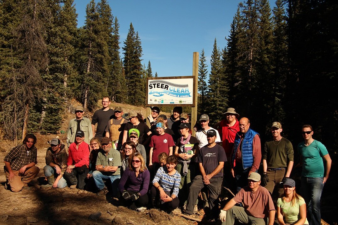
That is why the OWC’s Headwaters Action Team is now working towards bringing the science and social need (we all live downstream!) for water and watershed health to Dutch Creek this summer
.
Our first step will be to work on awareness and education programs with stakeholders and user groups around the need to reclaim some problematic linear features, and to encourage greater awareness of impacts of use on water and watershed values.
With greater understanding, we expect some measure of behavior change will be a result –
that people will voluntarily stick to designated trails and camping areas, avoid wet areas and riparian zones, use bridges over streams, and that this change in behavior will become the norm.
Some have told us we are dreamin’, that this is a big ask, but we have to start somewhere!
So what can
you
do?
If you are recreationist or other user of the headwaters area – for whatever purpose, the big ask is to understand why better linear feature management is needed, and to support and adhere to designated trail and access management outcomes of the SSRP.
It would also help if reclamation and restoration work on linear features is respected and supported by not undoing this good work through carelessness or worse, willful destruction.
Both of these attitude or behavior problems are counter-productive for sustainable water/watershed values that we need now and into the future.
We all think it is the
other
s who are responsible for these issues, but reality is – we are
all responsible
and we
all need
to take action!

Avoid the muck! Help stop erosion and loss of ecologically important wet areas!
Through the Dutch Creek Pilot Project, the Headwaters Action Team hopes to have a success story that can be used as inspiration and a guide for community and watershed stewardship groups and stakeholders to address linear feature impacts in other problematic sub-watersheds in the Oldman Headwaters, and indeed, in the Eastern Slopes region of Alberta.
We have a lot to do, but the idea is timely and needed, people and stakeholders are committed to this challenge, and partnerships are working towards achieving this worthwhile outcome.
If you feel this effort is worth supporting,
please donate to the OWC for this important work for the headwaters!
(OWC is a registered charitable organization - all donations are provided a tax receipt).
Please visit: www.oldmanbasin.org to make your donation go to work for the watershed!

Connie Simmons
Planning Manager
100, 5401 – 1
st
Avenue South
Lethbridge, AB. T1J 4V6
Work: 403-627-1736
Cell: 780-816-0654
Web:
Blog:
http://oldmanwatershed.blogspot.ca/
Twitter: